- RFID and GIS integration enabled end-to-end visibility of fossils from dig site to repository.
- Durable UHF Seal Tags and TSL 3166 readers performed reliably in remote, harsh field conditions.
- The pilot cataloged 347 fossils in five days and reported an 80% improvement in workflows.
- Cloud-synced, standardized data capture reduced manual-entry errors and preserved specimen provenance.
The process of tracking a fossil from excavation to analysis often encounters challenges with data loss and inconsistencies. However, a groundbreaking method for fossil tracking is revolutionizing the process, courtesy of a collaborative effort between pioneers in asset management and two committed organizations.
Leveraging robust RFID tags and RFID readers from HID alongside cutting-edge technology from Inframarker by Berntsen and Esri, the Earth Sciences Foundation Inc. (ESF) — a non-profit organization with excavation and fossil preservation expertise — and the Standing Rock Sioux Tribe — whose ancestral land holds the paleontological site — have come together for a historic achievement.
Challenges in Fossil Tracking
Traditionally, field notebooks served as the primary repository of information, capturing location coordinates, sketches, and field numbers — a complex code encompassing site details, discovery dates, and taxonomic clues. However, upon leaving the excavation site, these notebooks often become separated from their corresponding specimens, resulting in a significant disconnect between crucial context and the physical fossil itself.
At the storage facility, the reliance on paper spreadsheets for fossil tracking creates additional inefficiencies. Manual data entry is susceptible to human error, leading to inconsistencies and inaccurate location information. Thus, retrieving a specific fossil can become a separate time-consuming treasure hunt within itself, hindering research workflows.
The process of preparing fossils for additional study presents yet another hurdle. Removing the protective jackets, a necessary step for analysis, severs the physical link between the specimen and its field number. This disassociation further complicates the ability to connect the fossil back to its crucial contextual information documented in the field notebook, potentially delaying accurate classification and interpretation of the data.
A Three-Step Process to Track Dinosaur Bones
Leveraging SlimFlex Seal Tags and TSL 3166 RFID readers from HID, Inframarker’s RFID marking products, and Esri’s field mapping software, the solution encompasses a three-step process to track and manage dinosaur remains at the Standing Rock Sioux Tribe lands in South Dakota. The process ran as follows:
Step 1 — Tagging and Data Capture
Step 2 — Consolidated Information
Step 3 — Secure Transport and Ongoing Tracking
With ArcGIS online, ESF can view a map of bones (original and current location), a complete record of each bone, and a dashboard of daily/weekly/ monthly actions. As an added bonus, third-party organizations can be granted access to this information. In the case of Standing Rock — the bone owners — they were able to accompany the bone assets’ journey without having to be on-site.
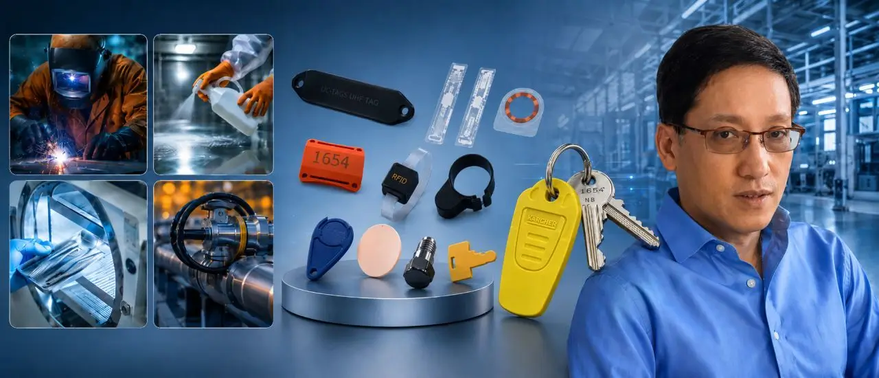
Robust RFID Hardware for All Weather Conditions
In order to ensure that track and trace was possible at the dig site, the chosen hardware had to be able to withstand the adverse weather conditions at the dig site. HID's Seal Tag transponders integrate RFID chips with high durability components and secure, tamper-evident fasteners.
In this application, the UHF RFID Seal Tag is identified and updated with the handheld TSL Bluetooth RAIN UHF Reader 3166. The reader uses the latest generation of silicon and can read up to 1,200 tags per second. Multiple tag operations per tag are possible during an inventory scan. This means that the reader is able to read multiple areas of each tag, is capable of writing data, and can lock the tag data if needed.
The on-reader de-duplication feature for one million transponders ensures that the connected host is not overwhelmed with information. Increased power efficiency of the internal hardware enables long operating times. This is especially important at remote locations like dig sites, where power sources are scarce.
Project Success: 347 Fossils Cataloged
The solution proved to be a resounding success. Within just five days, the excavation team had seamlessly cataloged 347 fossils, demonstrating the rapid adoption and efficiency gains offered by this innovative approach.
There was an 80 percent improvement in workflows, as the solution reduced the burden of manual data entry and administrative tasks. This freed up valuable time for the field technicians to focus on core activities like research and fossil conservation. To that end, because data capture is standardized, consistent information is collected for every fossil, facilitating a more comprehensive analysis.
More importantly, the combined power of HID tags and readers with Inframarker’s RFID system delivered near-perfect accuracy in tracking fossil movement and location throughout the entire preservation process. Throughout the process, all RFID interrogation data was collected in the cloud, providing near real-time visibility of bone status by auditors hundreds of miles from the dig site.
Using RFID technology, GIS mapping, and geospatial curation, as well as creating a whole fossil tracking system, we are able to see the life of this fossil from the time we found it in the ground, to the time we put it in the repository or storage building, to the time we prep it, clean it, restore it, and display it in the museum. This allows people to follow the adventure of this bone from beginning to end, as well as allows us and other scientists to do better research, collaborate easier, and exchange ideas faster. I know where everything is—right now. I can’t speak glowingly enough about how well this works for us out here. We are in the middle of nowhere; there’s no wi-fi connectivity here, and it still works!
Thomas Hebert - Founder and Director, Earth Sciences Foundation
This project is the proof that any organization that needs to track and manage assets across space and time will benefit from incorporating RFID with their GIS.
Mike Klonsinski - President, Berntsen International
Read Next: Bringing Technological Innovation to Paleontology – Interview with Thomas Hebert on RFID in the Field.
Anja Van Bocxlaer - Managing Director, Think WIoT