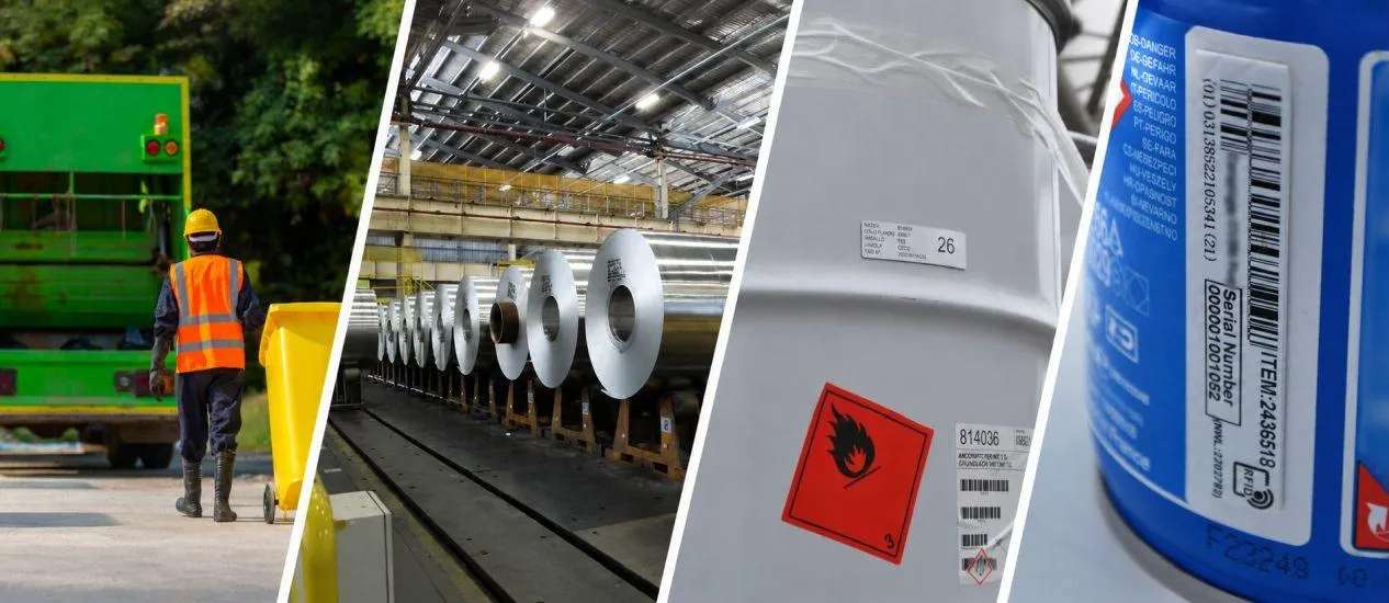
- RFID combined with GIS enables highly accurate, durable tracking of fossils and artifacts in remote field conditions.
- Field workflows require minimal technical expertise and synchronize to GIS platforms when connectivity returns.
- Digital twins and in-ground tags support risk mitigation, reconstruction, and broader public access to collections.
- Geospatial curation with RFID can preserve oral histories, languages, and cultural context alongside physical artifacts.
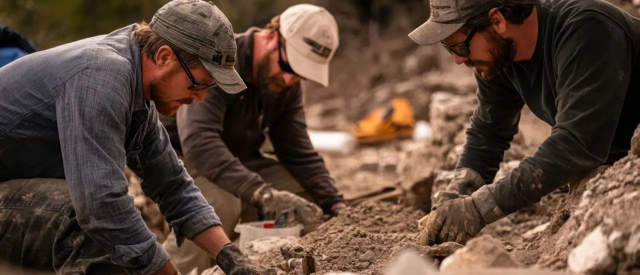
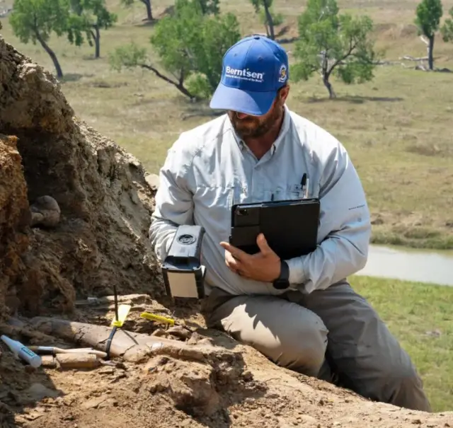
RFID and dinosaur bones. What do these two terms have to do with one another? Thomas Hebert, Founder and Director of the Earth Sciences Foundation (ESF) is one of the first who have seen the potential and benefits RFID brings to the field of paleontology. 347 fossils from a dig-site in South Dakota have already been successfully tagged and cataloged with an RFID-based fossil tracking solution.
By using RFID (Radio Frequency Identification) technology, GIS (Geographic information system) mapping, and geospatial curation, paleontologists are able to track any uncovered fossil.
But what makes RFID ideal for the field of paleontology and for use in museums or national parks? How can different aspects of culture be preserved with RFID? What does this mean for other atypical industries that may want to consider using RFID? In this interview with Think WIoT, Thomas Hebert shares the answers to these questions. The article is written by the Think WIoT team.
Interview with Thomas Hebert
1. Mr. Hebert, you’ve been actively involved with RFID technology in the field of paleontology for over 3 years now. What makes RFID the ideal technology to use in this field?
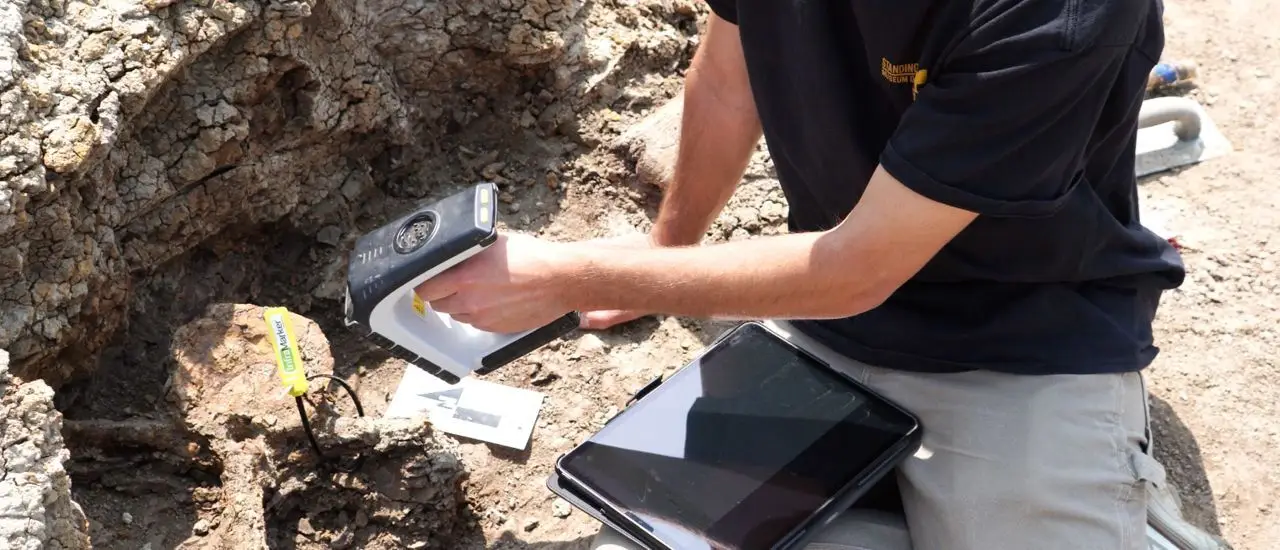
Thomas Hebert: The beauty of the technology and the whole system, is that it’s so simple to use. You don’t need GIS expertise or advanced training. It’s as easy as scanning a QR code.
To me, this makes it so exciting, and I’m a strong believer in this technology because if someone like me can use it—and if it makes sense and is easy for me—anyone can do it. I’m not a tech person by any stretch of the imagination. I don’t know the first thing about coding or the technical aspects of it.
But I do know that I can go out, read an RFID tag, open the Survey123 form on my iPad, fill it out, hit the checkmark, and it’s mapped. That’s it. Then, I can go back, reopen the form, make updates, and save it. It’s updated on the GIS platform. Your production manager back at the office can watch the map while you’re out in the field. It’s such a fast, efficient way to work. The old, archaic methods of doing things should go the way of the dinosaurs—and I’d know, I dig them up!
And if I’m capable of using RFID, being as tech-illiterate as I am, the sky’s the limit for those who truly understand technology and its inner workings, from coding to everything else. They can get it to do even more than I could ever imagine.
I think it’s a really interesting application in the field of paleontology, and it’s much more durable than people may realize. We work in an environment that some people would consider hostile. It can get as hot as 100 to 125°F out there, with 40-50 mile-an-hour winds blowing and dirt everywhere. Despite all that, the technology performed perfectly—it had no issues whatsoever.
2. When did you first hear about RFID technology?
Hebert: I got into dinosaurs late in life and decided to go back to college. While I was there, I took a class on GIS and thought, 'Why can’t I use this to map out my dinosaur dig sites? This seems like a no-brainer.' So, I did it—and I ended up being one of the first people in the world to map out a dinosaur dig site with GIS.
We achieved seven-millimeter accuracy on X, Y, and Z coordinates. It’s extremely precise. If I told you a point was right there, it was right there—not somewhere within a vague 12- or 20-meter radius.
I presented that work and partnered with a company called Carlson Software to create the map. Carlson then invited me to a few trade shows to talk about what we had done. It all started as a simple conversation at one of these trade shows with the company Berntsen who were doing RFID tagging. I thought, 'Let’s do this with dinosaur bones.' And that’s how this idea began.
To test the system, we conducted a case study at a remote site in South Dakota with no internet and limited cell service. It worked flawlessly—tags communicated via Bluetooth to an iPad. For me, that was the big 'aha' moment—this technology works anywhere. If you have a cellphone with Bluetooth or an iPad along with the RFID reader, you can make this system work.
Does it upload to GIS immediately? No, it doesn’t. You need connectivity for that. But when you get back to your hotel, your camp, your home office, or wherever you’re staying for the night, all you do is open the app, go to the outbox, and it’ll show you the unsent data. You hit send, and it’s uploaded. As soon as you send it, the data appears in the Field Map application. It’s accessible on ArcGIS Online, and from there, it can be shared across your entire organization.
3. What recent or current projects are you currently working on in paleontology and related fields?
Hebert: We’re actually working on a lot of projects right now. For example, we did a case study with the Standing Rock Sioux Tribe, and now they’re fully integrating RFID technology into their entire collection. Soon, we’ll be tagging their entire dinosaur collection for them, and we’re starting that in the next few weeks. (Read also the dinosaur bones story here)
We actually RFID-tagged and integrated an entire museum in Wyoming into GIS. We’re waiting to hear back from a very large, world-renowned museum in the U.S. That would be a huge story—it’s a big deal.
Right now, we’re also working with a large national park here in the U.S. to create a full digital twin of the park and integrate RFID technology into the monuments, markers, and other artifacts. From an inventory standpoint, its understanding what’s out there. What are all the anthropological specimens out here? The goal is to know exactly what’s in the park. That’s why we’re so excited about this project.
4. What are the benefits of using RFID technology in combination with a digital twin for the national park?
Hebert: One of the big benefits we’ve discovered with RFID tagging is the precision of the GPS coordinates we’re capturing. With this digital twin technology, we can create interactive exhibits that allow people to engage with the park in new ways. For example, someone could visit the park’s website, open up a map, click on a specific point, and instantly access detailed information, photos, laser scans, and 3D imagery. This makes it possible for people who can’t physically visit the park to experience it from the comfort of their home—whether on a laptop, iPad, or another device.
From a risk mitigation standpoint, wildfires are a major threat out west in the U.S. If a wildfire swept through the park, it could destroy monuments and other historical artifacts. But with a digital twin and in-ground RFID tags, we could go back, scan the tags, and know exactly where everything was. For example, we could recreate a headstone and place it precisely where it had been. And it’s not just wildfires, we’ve got tornadoes, vandalism, or theft. This technology allows us to preserve history without disrupting the visitor experience. We’re not talking about large, obtrusive tags—it’s still aesthetically pleasing when you visit the park.
We can now go back and recreate these monuments, markers, and even the entire park. We’re really excited to move in this direction and take historical curation to a whole new level.
5. Can other aspects of culture also be preserved with RFID?
Hebert: Absolutely. Language and history are also things we can preserve with this technology. Textbooks and other physical resources can get lost or damaged over time. One of the challenges we’ve seen, especially in our work with Native American tribes, is the loss of oral histories as tribal elders pass away. When they’re gone, they often take their culture with them.
This technology allows us to geospatially curate these stories, preserving them in a way that integrates full interviews, language lessons, and more into the tagging system. It becomes a fully immersive educational platform in addition to its curatorial function.
I think RFID technology is an incredible opportunity, not just in paleontology or archaeology, but across so many industries. If you have an asset and you want to know where it is, what condition it’s in, where it’s been, where it’s going, who’s touched it, who’s looked at it, who’s talked about it, we can create a solution for you for that. And it’s very simple and easy to implement.
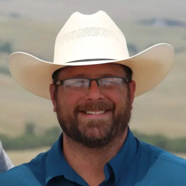
Thomas Hebert - Founder and Director
6. How does RFID technology increase public engagement in museums?
Herbert: One exciting application we’ve been exploring is with museums that have active dig programs. For instance, a dig team might be out in the field in, say, Wyoming, while the museum itself is located in Ohio. With this system, the museum could set up a large TV or smart board in their exhibit space, and as soon as the team finds something in Wyoming, it would appear on the screen in real-time or shortly after.
This creates a unique opportunity for public engagement. Visitors to the museum can see what the team discovered today or yesterday and what’s coming to the museum. For example, they might see, 'Wow, they just found an Allosaurus jaw, and it’s on its way here!' It keeps the excitement alive and fosters ongoing engagement.
For me, this is also an incredible way to get young people engaged in science. It offers an informal educational setting for kids, who have essentially grown up with smartphones and iPads in their hands. This is a way we can get young people interested in older sciences like paleontology, archaeology, and anthropology. Integrating high-level technology into these fields is helping to draw them in. This could help bring more young people into these career paths.
7. What is your personal mission and how does RFID help you achieve your goals?
Herbert: I’ve been excavating dinosaur fossils for 15 years and founded the non-profit Earth Sciences Foundation (ESF) in 2022 to inspire young people to explore paleontology. Our mission goes beyond excavation; it’s about reconstructing the lives of these creatures and understanding their environment to draw insights relevant to today and the future. It’s about getting young people involved and showing them that this is a viable career. This is technology-driven.
We engage students by linking paleontology with practical applications in math, science, and communication. For example, using algebra to estimate a dinosaur’s size or practicing clear communication to share findings. This approach has been particularly impactful for Native American youth, fostering cultural reconnection and preserving endangered native languages.
All of this ties back to RFID. It’s about creating story maps and using RFID tags at historical sites. By placing tags at historical sites and embedding contextual data, such as recordings of tribal elders’ stories, we can ensure this knowledge is not lost and promote cultural awareness. This is something we’re in desperate need of as a society, globally. As society faces the loss of knowledge and wisdom from retiring generations and diminishing mentorship, RFID offers a solution to curate and safeguard valuable information for future generations.
8. Are you spreading the use of RFID in other industries as well?
Herbert: We’re definitely moving into new areas with this technology. A solar panel company recently asked if we could tag their panels for tracking maintenance and inspection records. It’s exciting to see how different industries are adopting this same technology. Take the renewable energy sector, for example. Germany has some of the largest windmill farms in the world.
Companies need to be able to manage their assets and equipment from these farms remotely. With this system, a technician's inspection report can instantly appear in the office or even at a manufacturing plant located in another country. It’s thrilling to imagine how far this technology can go and really make a difference.
While renewable energy and climate change are vital focuses, we still need resources for electronics and daily life. If we can’t grow it, we have to mine it. This technology could inspire young people to enter industries like mining with a focus on doing it more sustainably. We rely on materials like copper for wiring, devices, and cookware.
The question is, how can we extract these resources with minimal environmental impact? For example, ESRI’s 3D scanning technology could be used to scan an underground mine and geo-reference everything with RFID tags. In the mining industry, this could mean real-time monitoring and daily updates instead of infrequent scans, taking resource management to a new level.
We’ve also had some unusual requests, like a hunter wanting to replace his paper notes with a system using RFID tags on hunting stands. By tagging the stands, it would be possible for him to record data like wind, barometric pressure, and other conditions, which would then be curated and mapped. Using ArcGIS’s search and sort functions, the system could tell him which deer hunting stands are likely the best choice for that day. It’s a unique application of technology, and I enjoy tackling challenges others think are impossible.
For our foundation, our vision statement says, 'If the door to curiosity is closed on you, we’ll be there to kick it open.' That’s exactly what we do—bring us a crazy idea, and we’ll make it happen. Even unconventional ideas, like using RFID for hunting, can have practical value with real benefits.
Thomas Hebert - Founder and Director