
Bluetooth AoA and GNSS Guide Rescue Drones Back to Moving Vessels

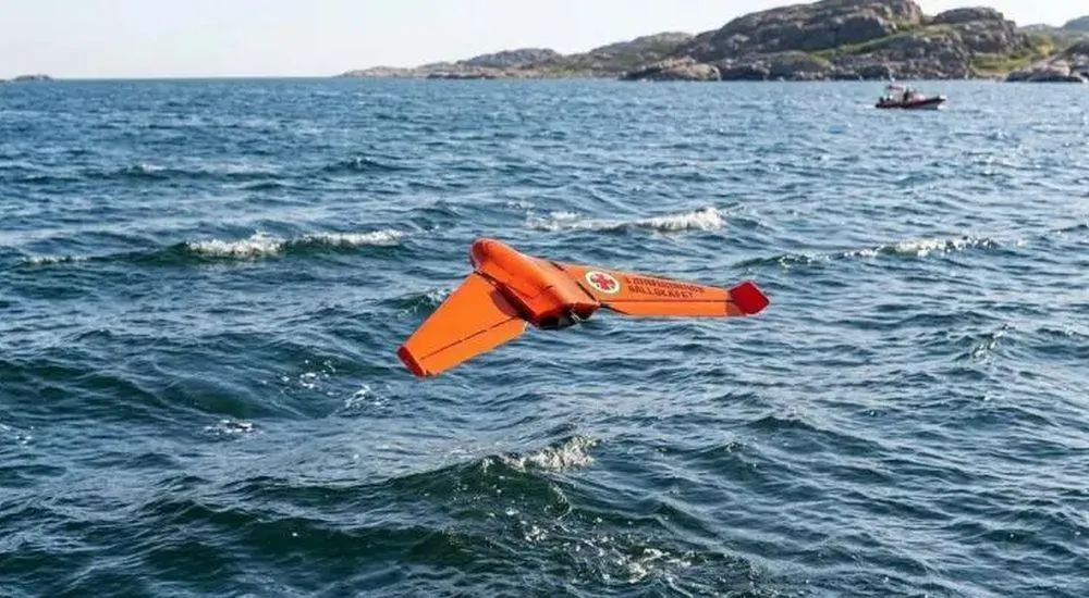
How does a rescue drone find its way back to a ship that is constantly moving? Researchers at Lund University are combining GNSS, Bluetooth 5.1 Angle of Arrival, and inertial sensors. In field tests, the system achieves a relative positioning accuracy of about one meter.
Drones can quickly survey large areas from the air during search-and-rescue operations at sea. Fixed-wing drones, in particular, offer long ranges and flight times. However, there is a key challenge to their use by rescue boats: after the mission, the drone must find its way back to a ship that is moving and constantly changing position due to waves.
A research project at Lund University addresses precisely this challenge. In collaboration with u-blox and the Swedish Sea Rescue Society (SSRS), master’s student Beau Forrez developed a ship-based guidance system at the Vinnova-funded NextG2Com competence center that combines GNSS, Bluetooth direction finding, and inertial sensors into a unified positioning solution.
GNSS for Distance, Bluetooth AoA for Final Approach
As long as the drone is still some distance from the ship, GNSS provides the global position of both platforms. As the drone approaches, Bluetooth 5.1 Angle of Arrival (AoA) is added. An antenna array determines the direction from which the drone’s Bluetooth signal is coming.
GNSS thus indicates the global locations of the drone and the ship. Bluetooth AoA provides the direction of the signal. An Inertial Measurement Unit (IMU) simultaneously records the orientation of the ship and, consequently, the antenna array. Only the combination of this information enables relative positioning.
Ship Movement Must Be Compensated For
At sea, it’s not just the drone that moves. If the ship rolls or pitches due to a wave, the measured angle of arrival of the radio signal also changes. Without compensation, the system could mistakenly attribute this movement to the drone.
The IMU therefore records the ship’s roll, pitch, and yaw movements. Using this data, the Bluetooth AoA measurements are transformed from the ship’s moving coordinate system into a stable, Earth-fixed coordinate system.
An Extended Kalman Filter then combines GNSS, Bluetooth, and IMU data to produce a continuously updated relative position estimate.
About one meter of deviation in testing
The system was tested in both simulations and physical experiments. The motion compensation was able to separate the drone’s actual approach direction from disturbances caused by the platform’s motion.
In the physical tests, tracking deviations were around one meter. In the simulation, under the conditions studied, average errors in the submeter range were achieved.
A fully autonomous return or landing on a moving rescue boat has not yet been demonstrated. Limitations of the available drone hardware prevented full closed-loop testing. However, a crucial building block was validated: stable relative navigation between a drone and a moving platform.
Standard components from u-blox
Commercially available components from u-blox were used for the test setup:
XPLR-AOA-3 Explorer Kits for Bluetooth Direction Finding
ANT-B10 Bluetooth antenna arrays
C209 Bluetooth tags
ZED-F9R GNSS receivers
The project thus also demonstrates that such hybrid positioning does not necessarily require specialized aviation technology.
Hybrid Positioning Beyond Rescue Drones
The concept is not limited to maritime search and rescue operations. Similar requirements arise wherever both the object to be located and the reference platform are in motion.
Autonomous robots, vehicles, mobile machinery, or asset-tracking systems can combine global navigation with local radio positioning. The project thus illustrates a fundamental principle: GNSS and Bluetooth positioning do not compete, but rather complement each other.
Bluetooth Channel Sounding as the Next Step
Bluetooth Channel Sounding, introduced with Bluetooth Core 6.0, will open up additional possibilities for precise distance measurements in the future. In combination with Bluetooth Direction Finding for determining direction, high-precision RTK-GNSS for position determination, and sensor fusion for integrating measurement data, new possibilities for relative positioning are emerging.
The project already demonstrates why hybrid positioning is gaining importance for autonomous systems: what matters is not a single wireless technology, but rather the combination of the most appropriate positioning methods.
Further information: Ship-Mounted Radio Guidance System for Fixed-Wing Drone Recovery, master’s thesis by Beau Forrez, Lund University, 2026.