
Precision Location & Secure Ranging: How Modern Locating Works
Precision location and secure ranging technologies form a flexible ecosystem delivering accurate, trustworthy spatial information that optimally supports process needs and automation.
- Revised: September 28, 2026
- By: Anja Van Bocxlaer
- Read: 9 min
- Precision location adapts accuracy based on process requirements rather than applying a fixed standard.
- Secure ranging ensures the integrity and trustworthiness of distance measurements against relay attacks and data manipulation.
- Hybrid location systems combine multiple technologies to maintain accuracy and coverage across diverse environments.
- Location data enriched with identification and sensor inputs enables automated, context-aware decision-making.
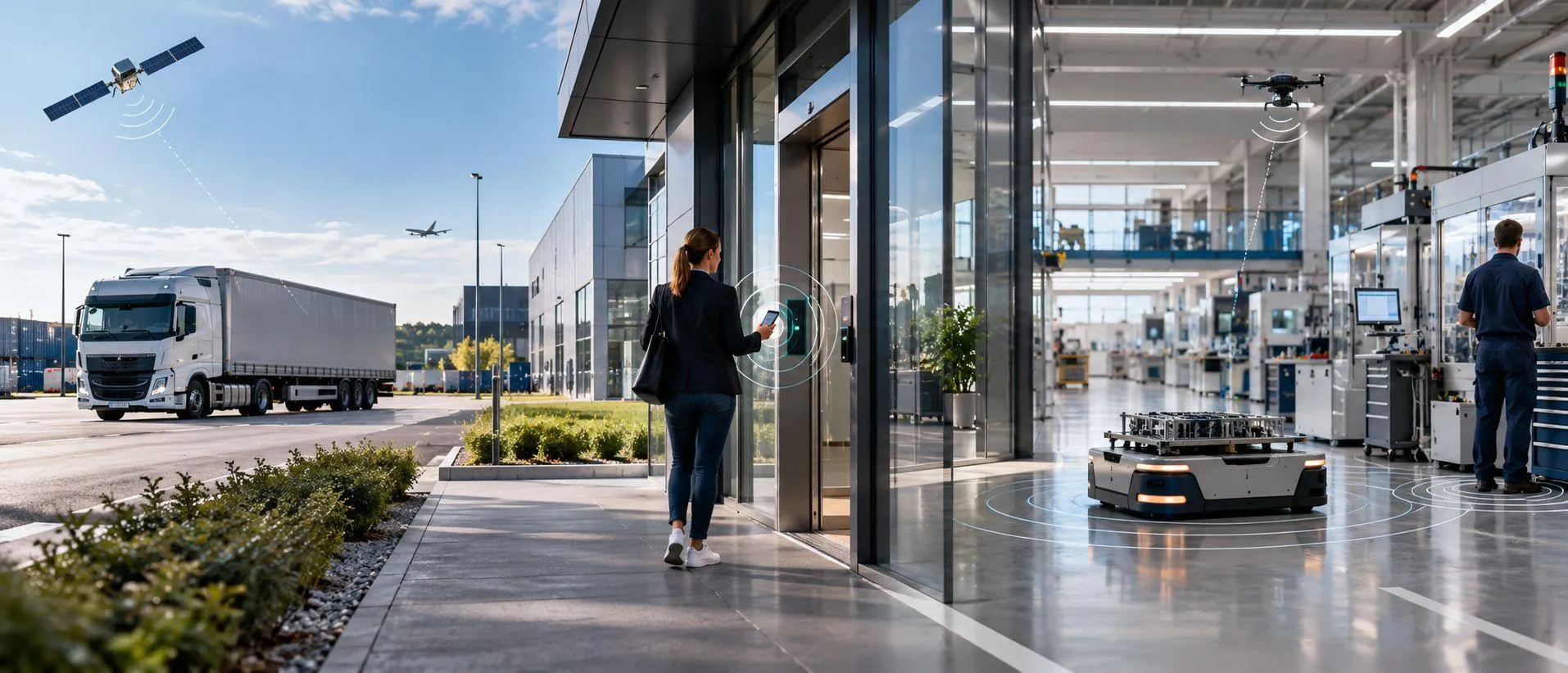
Modern location systems combine identification, positioning, direction finding and ranging to provide the spatial information a process actually needs.
Knowing where something is has become a fundamental part of the Internet of Things. Companies locate tools, vehicles, containers, machines, medical equipment and connected devices to support logistics, automation, security and asset management.
But locating is no longer one technology or one level of accuracy. A truck moving between countries, a pallet entering a warehouse, a tool reaching a workstation and a smartphone approaching a vehicle all require different forms of location information. Sometimes a rough position is sufficient; elsewhere, an exact distance must be measured and trusted.
Precision Location & Secure Ranging describes this broader field, from identification and presence detection to indoor and outdoor positioning, RTLS, direction finding, precise ranging and resilient positioning.
What Is Precision Location?
Precision location means determining the spatial relationship of an object, device, vehicle or person with the level of accuracy required by the application. There is no universal threshold that makes a location system “precise”.
A logistics operator may only need to know that a container has reached a distribution center. A hospital may require room-level localization. A factory may need to know whether a tool has reached the correct workstation. Robotics, digital keys and automated vehicles can require highly precise positioning or distance measurement.
Location can therefore mean identification at a gate, zone detection, coordinates, direction or distance. The key question is not how accurately everything can be located, but how accurately a specific process needs to understand spatial context.
Positioning, Localization and RTLS
Positioning generally means determining coordinates or a position. Localization often refers to finding something within a defined environment such as a warehouse, factory or hospital. Locating is the broader practical task of finding or tracking an object, device, vehicle or person.
A Real-Time Location System, or RTLS, continuously determines or updates location while an object moves. RTLS is not one radio technology; different wireless technologies can form the basis of an RTLS.
Secure and Resilient Location
As location data becomes an input for access, automation and safety, accuracy alone is no longer enough. Systems increasingly need confidence that distance or position information is genuine and remains available when radio conditions become difficult.
Secure ranging focuses on the integrity of a distance measurement. A digital vehicle key or access-control system must establish not only that an authorized device exists, but that it is genuinely within the required distance. Bluetooth Channel Sounding, for example, combines Phase-Based Ranging with Round-Trip Timing, which can provide secure distance bounding against relay attacks.
Resilient positioning addresses a wider problem. Satellite and terrestrial radio signals can be degraded, blocked or manipulated. GNSS can be affected by jamming, where interference overwhelms the signal, and spoofing, where false signals mislead the receiver. Resilience therefore includes interference detection, authentication where available and alternative positioning sources when one source becomes unreliable.
Secure ranging and resilient positioning are not identical, but both reflect the same development: location systems are moving from simply producing coordinates toward spatial information that can also be trusted.
Technologies Behind Precision Location
No single technology is best for every application. The relevant factors include accuracy, range, power consumption, infrastructure, scalability, security and cost.
Ultra-Wideband (UWB) is used for highly precise ranging and positioning, for example in industrial RTLS, tool tracking, indoor navigation, vehicle interaction and secure access.
Bluetooth Low Energy supports proximity detection, beacons and indoor location services. Bluetooth Direction Finding adds Angle of Arrival and Angle of Departure, while Bluetooth Channel Sounding enables precise distance measurement using Phase-Based Ranging and Round-Trip Timing.
GNSS provides wide-area satellite positioning. GPS, the U.S. Global Positioning System, is the best-known GNSS constellation. Modern receivers can also combine Galileo, BeiDou and GLONASS. GNSS is fundamental to outdoor tracking, transportation and logistics, but is limited inside many buildings.
5G and other cellular networks provide another location layer and can complement GNSS, especially where connectivity and positioning share the same infrastructure.
RFID is primarily an identification technology, but read events also create location information. Readers and antennas can establish that a tagged object has passed a gate, entered a zone or reached a machine. In hybrid systems, RFID can identify the asset while another technology determines its more exact position.
Wi-Fi, LPWAN and inertial sensors can add further location information where they fit the environment or existing infrastructure.
Beyond traditional GNSS, Low Earth Orbit satellite constellations are being investigated as additional sources of positioning, navigation and timing. Research has shown that Starlink communication signals can be exploited for opportunistic positioning. LEO positioning remains an emerging field, but it illustrates how future systems may combine more satellite and terrestrial signals.
Hybrid and Adaptive Location
Assets rarely remain in one environment, and they rarely require the same level of accuracy throughout a process.
A returnable container may travel from a production site through road transport, a logistics yard and a warehouse to a specific workstation. During transport, broad geographical positioning may be sufficient. At the site, zone information may be enough. At a critical production step, precise ranging may be required.
Modern location architectures therefore combine technologies rather than relying on one method everywhere. GNSS and cellular positioning can provide wide-area visibility; Bluetooth, Wi-Fi and RFID can support site and zone detection; RTLS and direction finding can add detailed indoor positioning; UWB or Bluetooth Channel Sounding can provide precise ranging where it matters.
The transition can also be dynamic. Higher-precision positioning may be used only at critical process points, while lower-power and lower-cost technologies cover the rest of the journey. This creates continuity between outdoor and indoor environments without requiring maximum accuracy everywhere.
It also changes the economics of tracking. A high-value asset may justify GNSS and cellular connectivity, while large numbers of lower-value assets can rely on BLE, RFID or shared infrastructure. Precision is applied where it creates operational value instead of being treated as a requirement for every object and every location.
The principle is simple: use the location method and accuracy that the process requires at that moment.
From Location Data to Sensing and Automation
The value of locating does not come from displaying a position on a map. It increases when location is combined with identification, sensing and condition monitoring.
Identification answers what an object is. Location shows where it is. Sensors describe what is happening to it.
A logistics platform can know not only where a shipment is, but whether its temperature remains within limits. A production system can identify a tool, verify that it is at the correct workstation and monitor its condition. A hospital can locate equipment while also understanding availability or device status.
The same principle applies to cold chains, mobile machinery, returnable assets or sensitive goods. Temperature, humidity, vibration, shock, pressure, movement or opening events can be evaluated together with location. The question is no longer simply whether something happened, but also where it happened and which asset was affected.
Once this context is connected to business rules, actions can be triggered automatically. A shipment can generate an alert when temperature rises at a critical location, a machine can start only when the correct tool is present, or maintenance can be triggered by abnormal sensor data.
Location, identification, sensing and condition monitoring therefore become complementary inputs for context-aware process automation.
How Do You Choose the Right Location Technology?
The right technology is determined by the process, not by the highest available accuracy.
If the requirement is only to confirm passage through a gate, RFID may be sufficient. Room-level visibility can often be solved with zone-based indoor locating. Continuously updated positions require RTLS, while exact distance or secure proximity can point toward UWB or Bluetooth Channel Sounding.
The environment then narrows the choice. GNSS is highly effective outdoors but not in most indoor spaces. Existing Wi-Fi or Bluetooth infrastructure can make indoor solutions more economical, while cellular connectivity suits assets moving across large geographical areas. Hybrid architectures become attractive when assets cross several environments.
Update frequency, energy consumption, scale and asset value shape the economics. A tracker reporting a few times per day has different power requirements from a device updating several times per second. Ten high-value machines can justify a different architecture from a million reusable packages.
The required range is equally important. A solution designed to determine proximity over a few meters addresses a different problem from one that follows containers across continents. Infrastructure must therefore be considered together with device cost: fixed readers or anchors may be economical when many inexpensive tags share them, while infrastructure-independent trackers can make more sense for widely distributed assets.
Security becomes decisive when location triggers access, unlocking or safety-related actions. Resilience becomes important where loss or manipulation of positioning data could interrupt a process. If condition monitoring is also required, sensors, battery life and connectivity belong in the same design decision.
The best solution is therefore rarely the technology with the highest accuracy specification. It is the architecture that provides the required information with the right balance of accuracy, coverage, update rate, power, infrastructure, security, resilience, scalability and total cost.
Location Becomes Spatial Context
Wireless IoT is transforming location from a tracking function into a broader layer of digital context.
Identification tells a system what an object is, sensors describe its condition, connectivity allows it to communicate, and location adds where it is. Direction and ranging describe spatial relationships; secure and resilient positioning add confidence that this information can be trusted.
When these capabilities work together, digital systems can understand not only individual assets but the context in which events occur. This creates the foundation for increasingly automated decisions and interactions between objects, machines, infrastructure and people.
That is the idea behind Precision Location & Secure Ranging: a flexible ecosystem that provides the spatial information a process needs with the necessary accuracy, security, resilience and economic efficiency.